$2.00
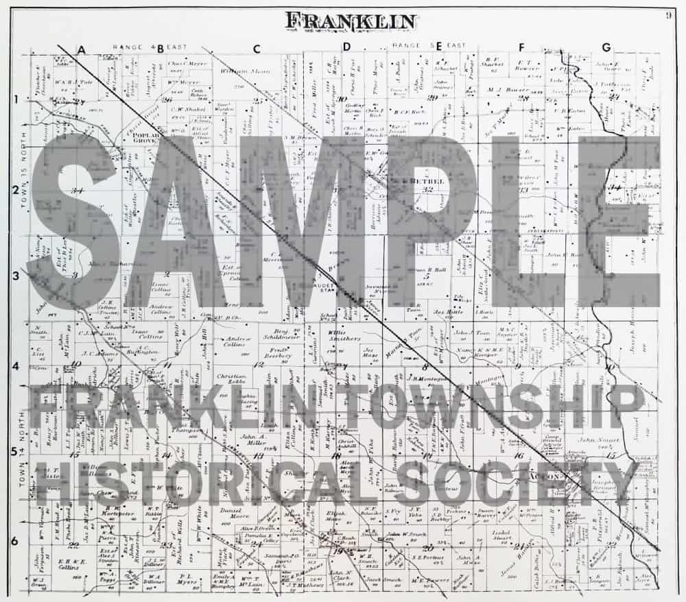
Paper map of Franklin Township, reproduced from an 1889 original, showing land holdings and the location of farm buildings. Some of the barns marked on this map are still standing today, and many of the landowners’ names are known to area residents as the names of the roads that run alongside or through their former farm properties. Actual product does not include watermark.
2 in stock
Description
Paper map of Franklin Township, reproduced from an 1889 original, showing land holdings and the location of farm buildings. Some of the barns marked on this map are still standing today, and many of the landowners’ names are known to area residents as the names of the roads that run alongside or through their former farm properties, including Thompson, McGaughey, Fisher, McGregor, Pentecost, Churchman, Maze, and others. Map includes New Bethel (now Wanamaker), Acton, Gallaudet Station, Poplar Grove, the Michigan Road (now Southeastern Avenue), the Shelbyville Free Pike (now Shelbyville Road), and more sites of interest.
Additional information
| Weight | .1 lbs |
|---|---|
| Dimensions | 14 × 11.5 × .01 in |

